|
|
Post by Władysław Anders on Dec 17, 2015 17:24:00 GMT
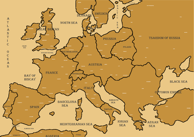
I MADE A MAP!!!!!!!!!!!!!!!  IS THIS NOT *Auto corrected*ING AMAZING!!!!! |
|
|
|
Post by Władysław Anders on Dec 17, 2015 17:25:03 GMT
The white things are cities, just zoom into it or something to see exact names
|
|
|
|
Post by Vatutin on Dec 17, 2015 20:12:27 GMT
When is the era like 1850's?
|
|
|
|
Post by saltin on Dec 17, 2015 20:37:45 GMT
Neat looking,what software did you use to make the map?
|
|
|
|
Post by Jean Lannes on Dec 17, 2015 21:25:02 GMT
It's a map of 1798 I'm guessing.
And just btw, it's the HRE (Holy Roman Empire) not Austria
|
|
|
|
Post by Władysław Anders on Dec 18, 2015 2:03:26 GMT
Neat looking,what software did you use to make the map? THE BEST IN THE WORLD= Paint  |
|
|
|
Post by Władysław Anders on Dec 18, 2015 2:07:53 GMT
It's a map of 1798 I'm guessing. And just btw, it's the HRE (Holy Roman Empire) not Austria Youre right,it is 1798. And yeah it is nit Austria yet....but trying fitting HRE into the map! |
|